Oceanographer - Satellites and (sub)mesoscale oceanic features
Eddy-driven transport in the Bay of Bengal
Mesoscale eddies, as observed through satellite altimetry, may facilitate cross-shelf transport in the western Bay of Bengal through filaments carrying coastal waters offshore. Cold, nutrient-rich filaments are observed at the periphery of counter-rotating eddies pairs, carrying water into the Bay’s interior, and contributing to the upper ocean stratification of the Bay of Bengal.
UCSD-Scripps


Frontal dynamics in the California Current System
Thermal fronts detected in the California Current System through remote sensing may exhibit distinct dynamics off Baja California than off California: in some instances, fronts were misaligned with mesoscale eddies in late summer-fall, suggesting that the fronts may be compensated and remain passive in the area. This stands in contrast with the traditional coastal upwelling scenario.
JPL-Caltech
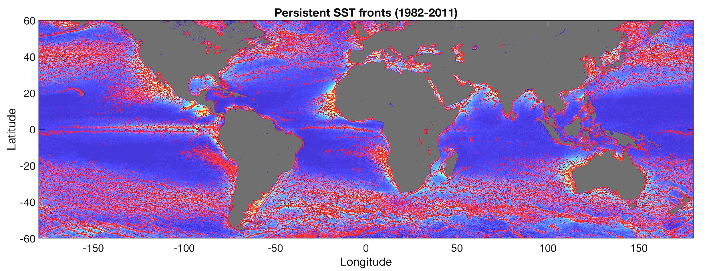
FROntal Detection in the Ocean (FRODO)
Automated detection of persistent thermal fronts based on global satellite observations.
URI-GSO
An algorithm -FRODO- was developed to detect objectively thermal fronts that are persistent over time, based on satellite observations from Pathfinder Advanced Very High Resolution Radiometer (AVHRR), and Moderate Resolution Imaging Spectroradiometer (MODIS) Aqua and Terra. Five global atlases were established, one based on the long-term mean location of the fronts, and four maps for each climatological season (30 years of Pathfinder data + 12 years for each MODIS satellite). Over 3,000 fronts were originally detected for each map, and their location and properties were saved. The improved version of FRODO currently detects over 6,000 frontal segments in average per map. The results are presented in the paper.
PhD thesis (2017) RSE paper (2022)
Update 12/15/2021: Paper is available, see link above ~